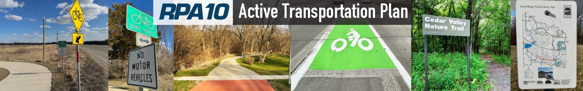
RPA 10 Active Transportation Plan
Draft Active Transportation Plan Available for Public Comment
Background:
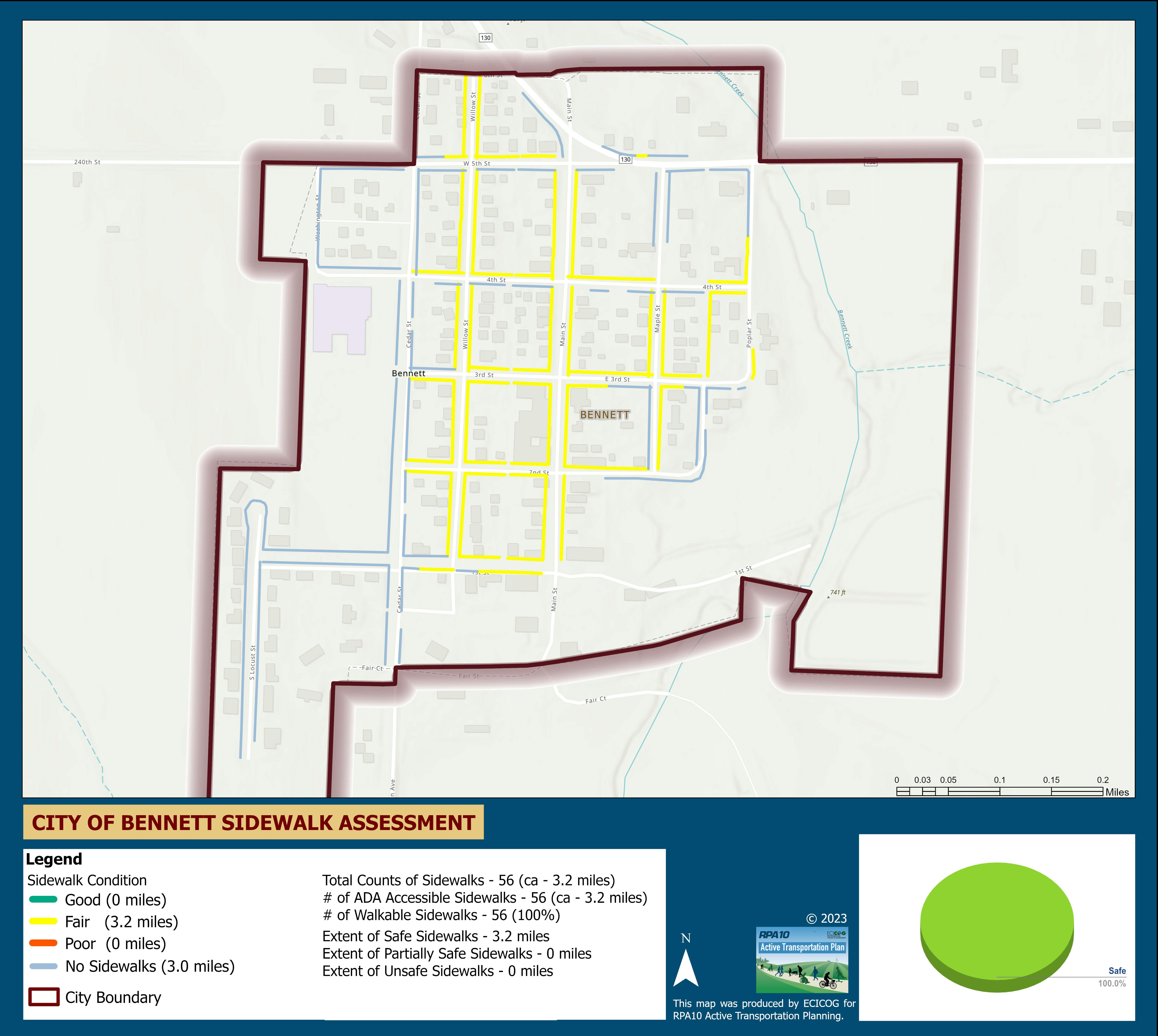
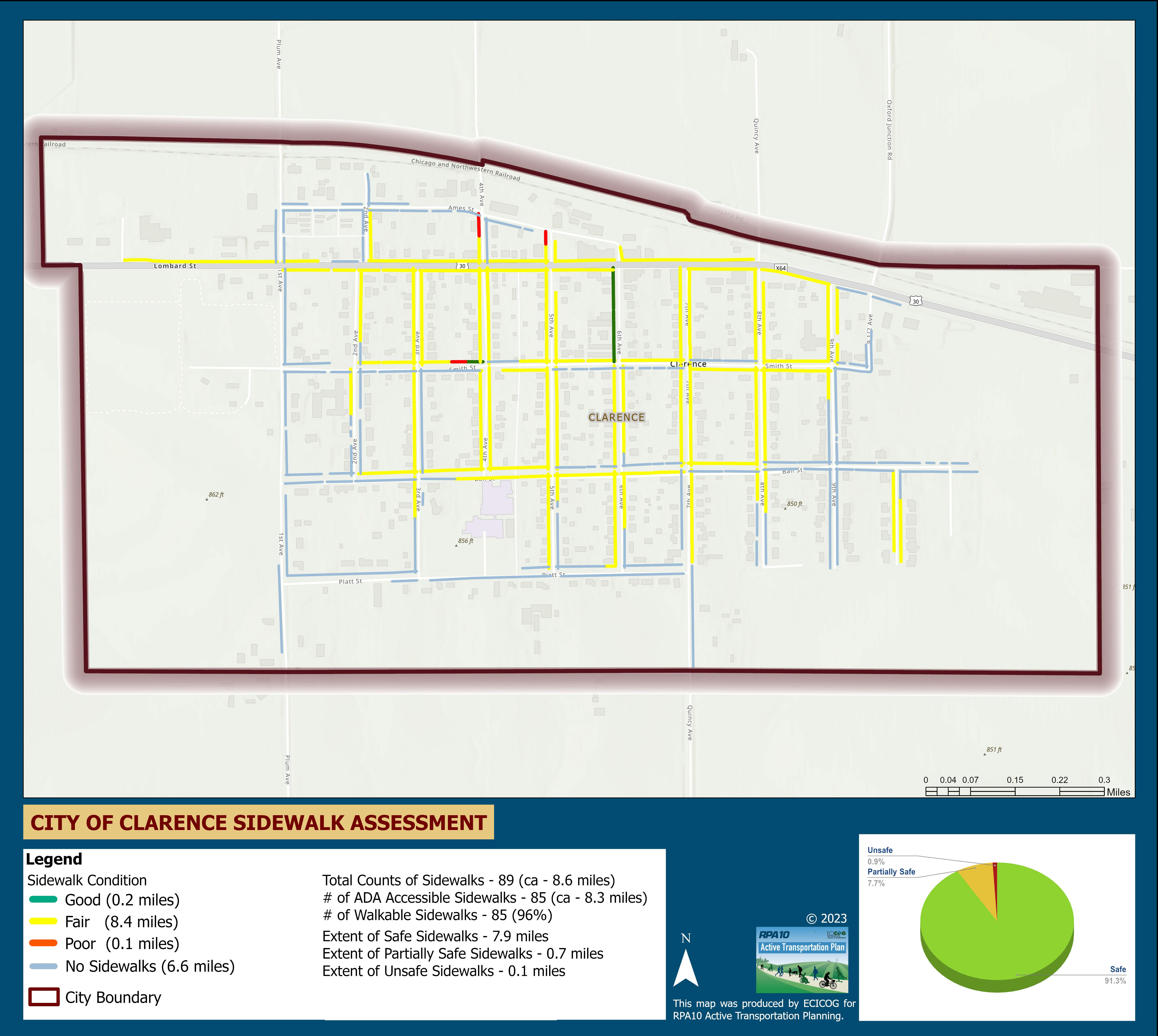
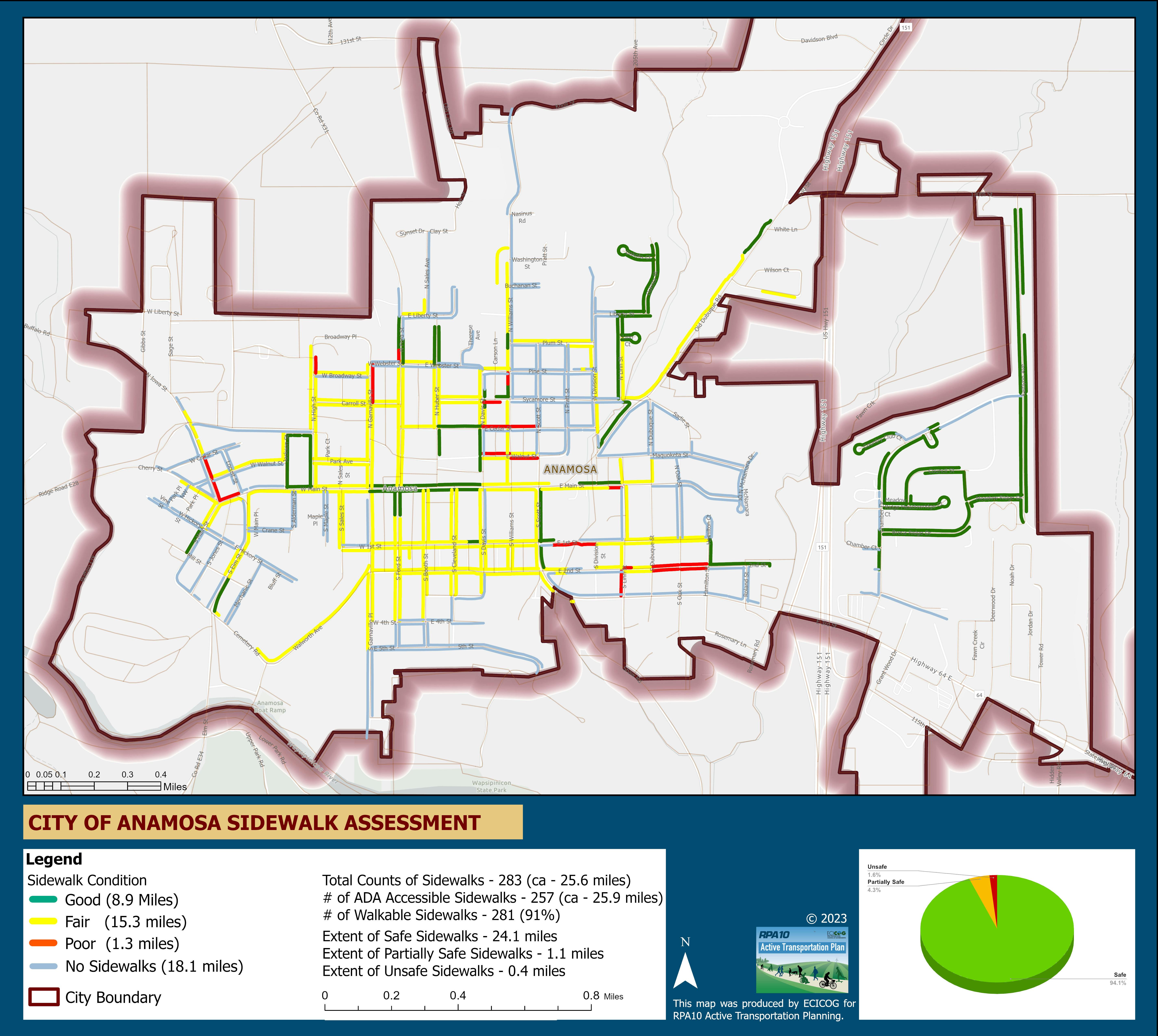
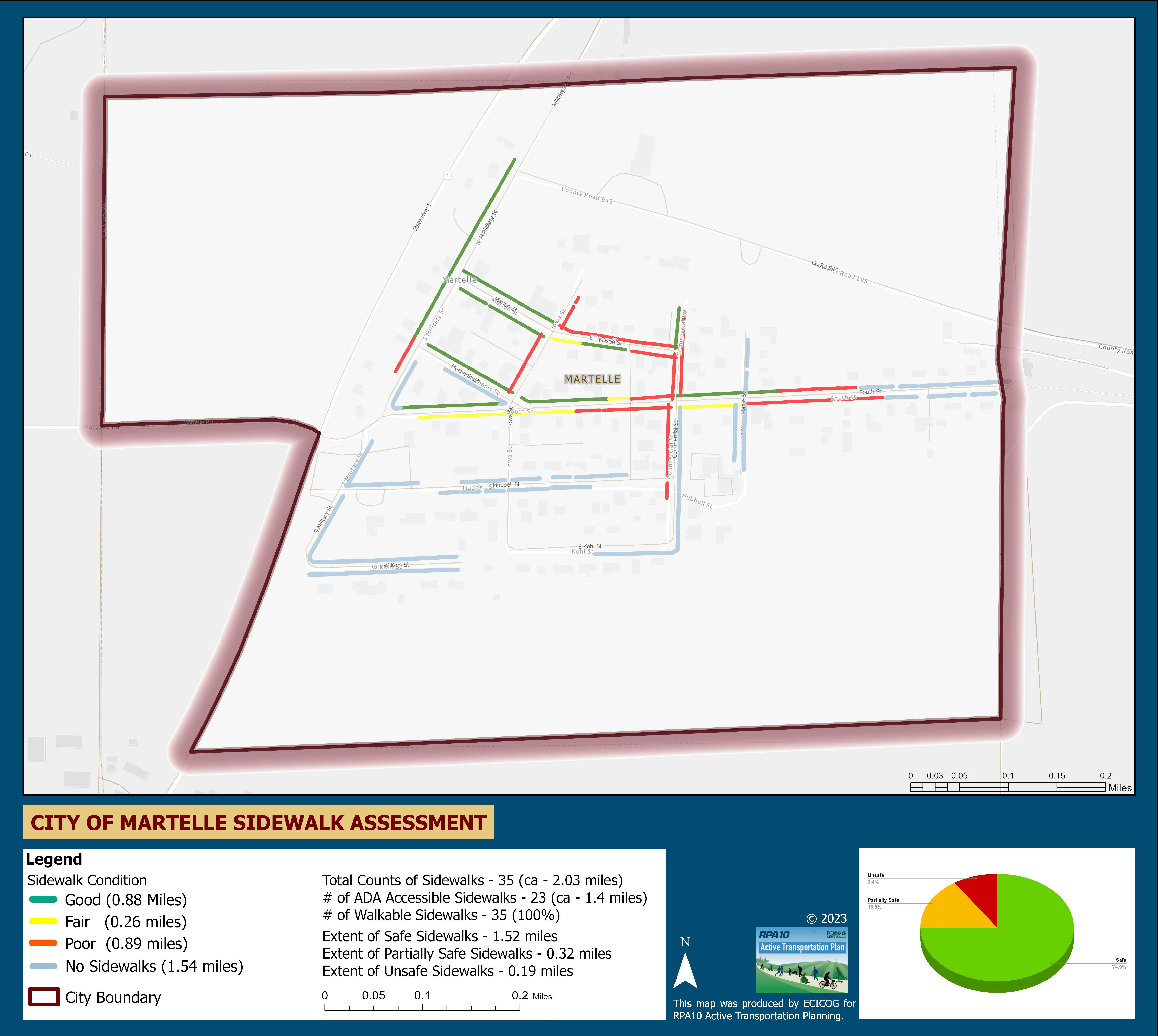
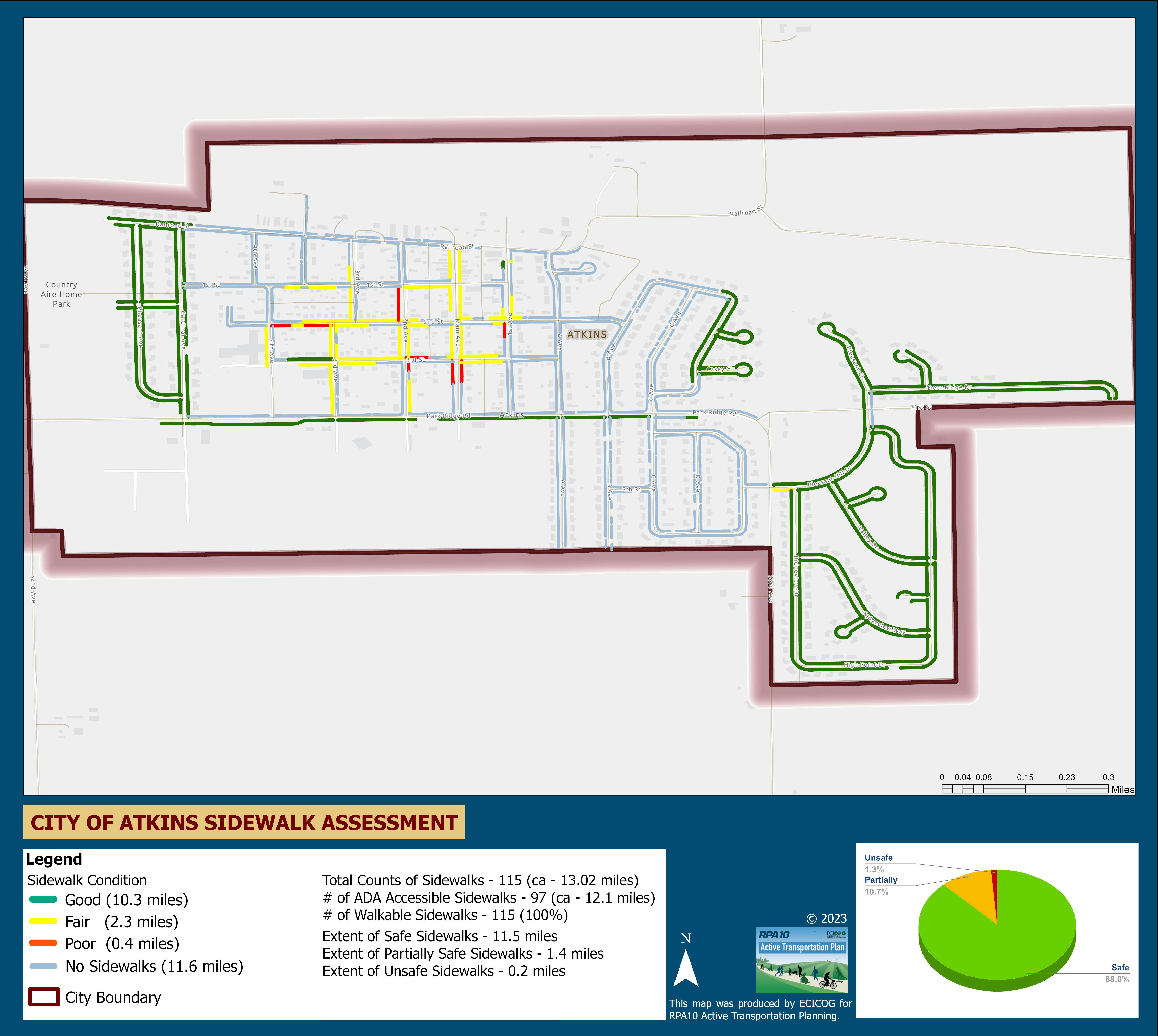
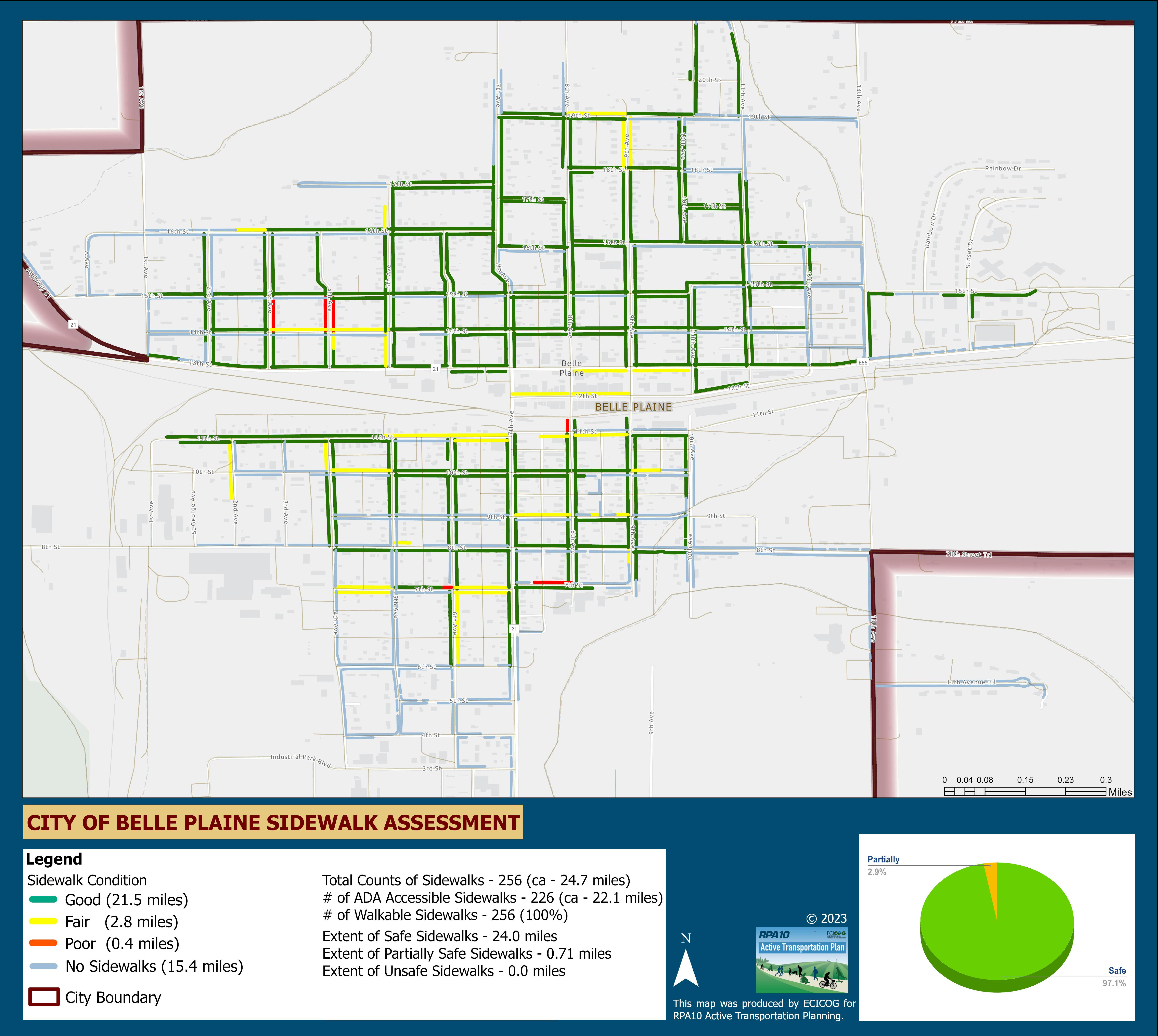
The Regional Planning Affiliation 10 (RPA 10) is working to complete the region’s first Active Transportation Plan. The Plan focuses on the non-automobile transportation network, including bicycle and pedestrian facilities. The Plan is designed to allow people to move independently within their community, and to experience the landscape between communities for travel or recreational purposes.
![]()
About RPA 10:
RPAs conduct transportation planning for non-metropolitan areas in the state of Iowa,
while urban areas are served by Metropolitan Planning Organizations (MPOs).
RPA 10 includes Benton, Cedar, Iowa, Johnson, Jones, Linn, and Washington Counties.
The Cedar Rapids and Iowa City areas, shaded to the right in green and dark blue respectively, are served by MPOs (Corridor MPO and the MPO of Johnson County) rather than by the RPA. However, the RPA always takes the entire region’s transportation needs into consideration when planning.
Active Transportation Survey:
RPA 10 is developing an active transportation plan and is seeking your input about opportunities for walking, running, and cycling in our region.
Click Survey below if you have input about or use any of the above transportation options. It will take just 5-10 minutes to complete. Please answer to the best of your ability; all answers will remain anonymous. Click Map to provide additional inputs about places you usually bike or walk to. The mapped data will be used in planning routes as inputs for the active transportation plan.
Please feel free to contact us at (319) 289-0063 or mary.rump@ecicog.org with any questions or comments. You can also engage with us by visiting the questions, forum and ideas tabs on this project website.
Thank you for your feedback!

Contact
-

Phone 319-289-0063 Email mary.rump@ecicog.org -

Phone 319-289-0075 Email justice.inkoom@ecicog.org
Documents
-
 ECICOG DOCUMENTS
-
DASHBOARD
-
 Benton County ATP Dashboard.pdf (364 KB) (pdf)
-
Cedar County ATP Dashboard.pdf (341 KB) (pdf)
-
Center Point Survey Dashboard.pdf (361 KB) (pdf)
-
Hills ATP Dashboard.pdf (346 KB) (pdf)
-
Iowa County ATP Dashboard.pdf (337 KB) (pdf)
-
Jones ATP Dashboard Final.pdf (368 KB) (pdf)
-
Johnson County ATP Dashboard.pdf (347 KB) (pdf)
-
Linn County ATP Dashboard.pdf (368 KB) (pdf)
-
Washington County Survey Dashboard.pdf (330 KB) (pdf)
-
ECICOG RPA 10 Active Transportation Dashboard.pdf (366 KB) (pdf)
-
-
Open House Summaries
-
draft document compressed.pdf (12.9 MB) (pdf)